
Mandu is one of those places that I’d been planning to visit for many many years, and till now for one reason or another hadn’t managed to get to. So on my way back from Bangalore in August, I thought I’d make a detour and finally get to see the site. Despite a lack of reasonably-clean budget hotels, I wasn’t disappointed. :)
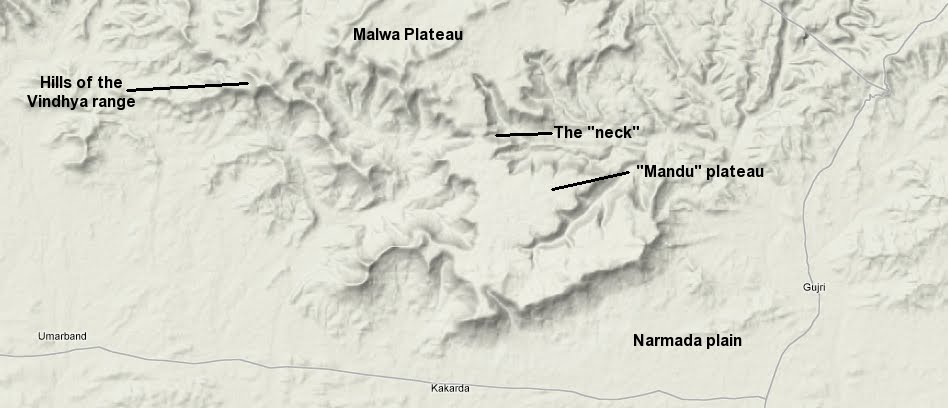
Mandu is my favorite kind of place to visit, not just because it’s an important architectural history site in India (which it is), and not just because it’s as interesting as other Deccan “sultanate” sites such as Bidar, Golconda, Bijapur, Ahmednagar and Daulatabad* that I studied as an undergrad, but also because it is located at the edge of a large geographical feature (the Malwa plateau, which covers many hundred square kilometers in central India). Such locations, on such edges, provide a context for us to comprehend these large geographical entities, which otherwise we can live on or near and never fully grasp.
*Come to think of it, Daulatabad was always in the hands of the Delhi Sultanate until it went to the Mughals, and was never a seat of its own sultanate, so in that respect was different to the other sites mentioned above.
Of course the fact that Mandu fort is located on the edge of such a plateau is not a coincidence – the cliffs and steep hills here provide excellent natural protection from invading armies. What is unique about Mandu’s location is that here, the plateau juts out into a wide spur that is connected to the main Malwa plateau by a very narrow neck. Mandu is located on this spur, and strong fortifications and a sort of moat on the narrow neck separate the main plateau from Mandu’s plateau.
The Google “terrain” maps below show what I’m talking about. Click on the maps to enlarge them.
Map showing the “Mandu plateau” attached to the Malwa Plateau to the north and surrounded by the plains of the Narmada to the south
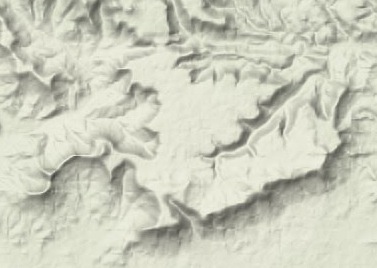
A close-up of “Mandu plateau”
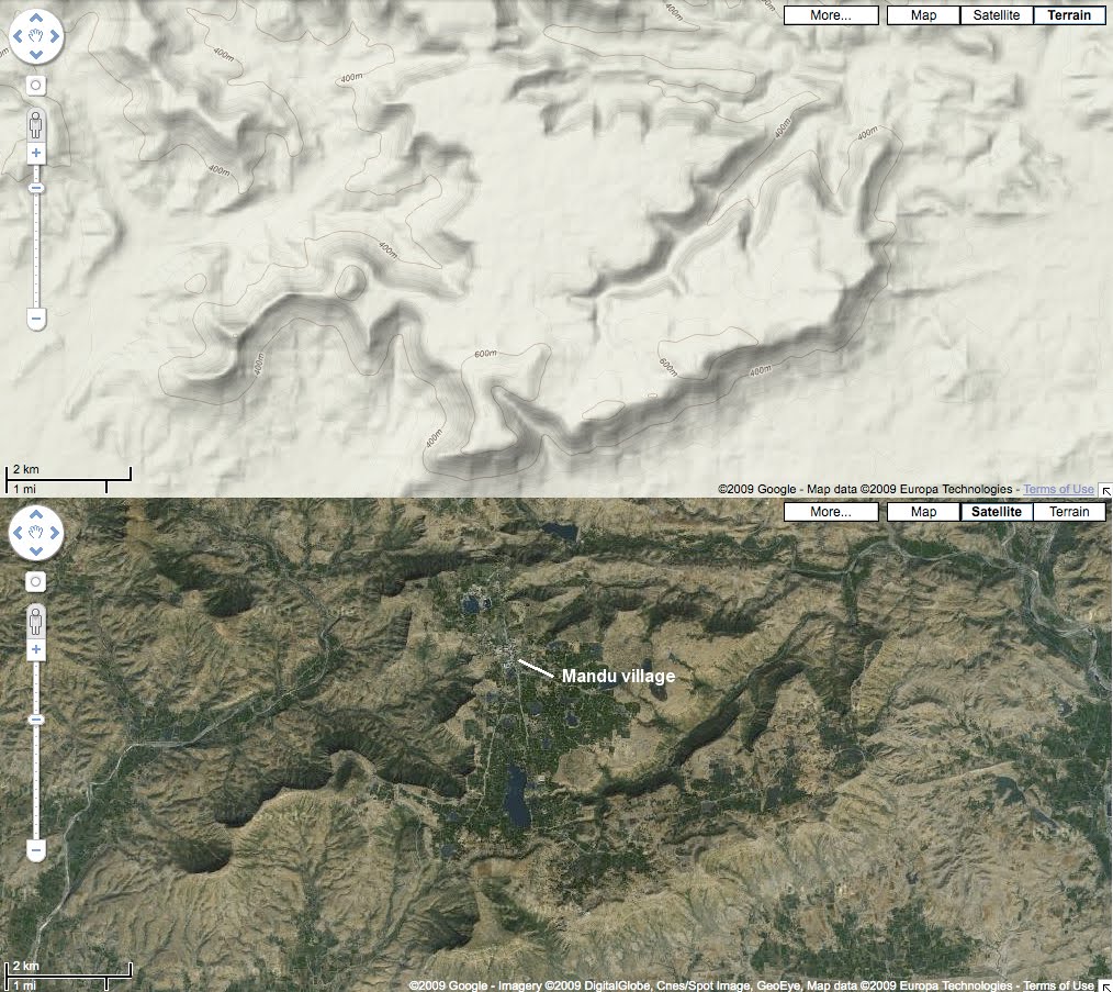
Terrain map and satellite image side-by-side. The green patches are cultivated areas. We can see the number of water bodies on the plateau (the largest one s Sagar Talao). The main village of Mandu is marked on the satellite image
So the Mandu plateau (if I can call it that) is a small spur (about 20 square kilometers) of the large Malwa plateau, and is attached to the Malwa plateau by a very narrow neck which, as I mentioned above, has been moat-ed and fortified to separate it from the main plateau – a perfect natural protection augmented by man-made fortifications, a guide would say.
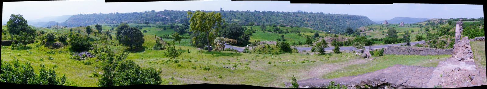
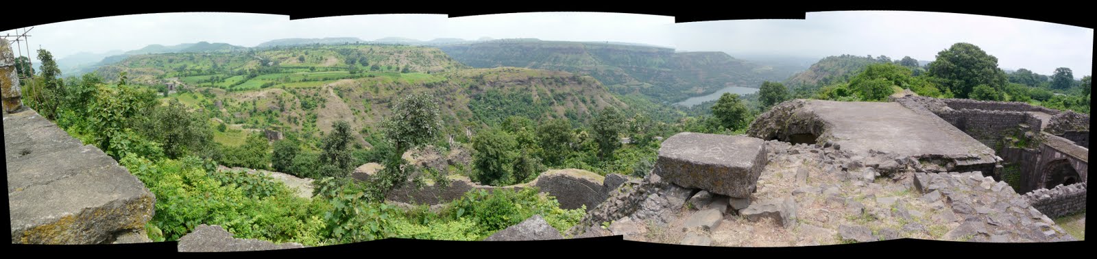
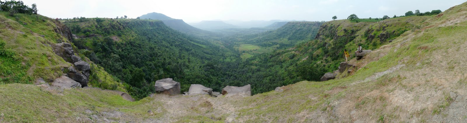
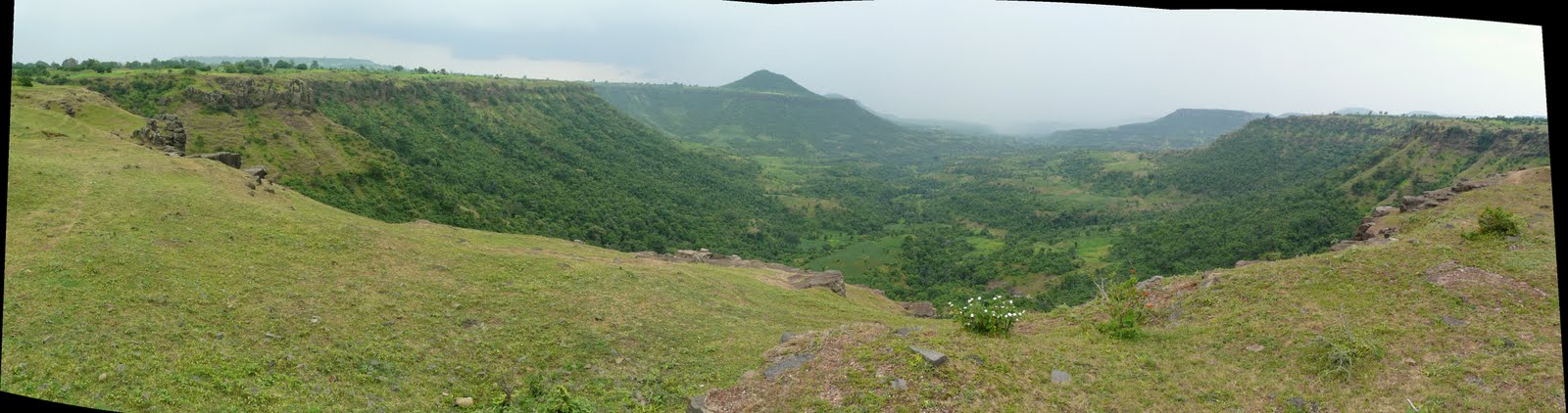
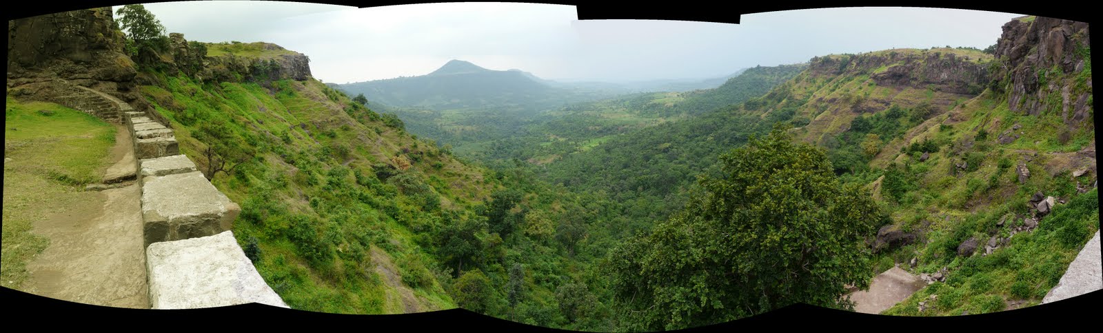
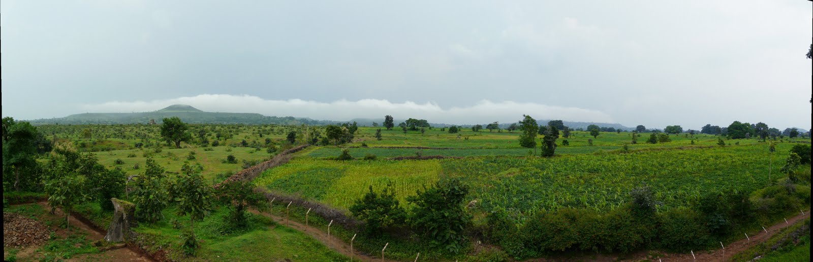
The panoramic photos below give an idea of the “Mandu plateau”, the Malwa plateau on the other side of the neck, and the plains of the Narmada a few hundred feet below. The hills jutting up from the plateau, including the conical Songarh hill on the Mandu plateau, belong to the Vindhya range.
Clicking on the panoramas will enlarge them. Click here for the flickr set with all these panoramas.
Looking from the Malwa plateau towards Mandu plateau, with the plains visible on the sides of and behind Mandu plateau
Looking from Mandu plateau (on top of the northern fortifications) towards the main Malwa plateau, with the ravines that seperate them visible to the right. The “neck” is on the left in this view
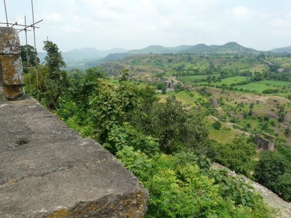
Looking towards the plains at the edge of Mandu plateau near Neelkanth’s palace
Looking towards the plains at the edge of Mandu plateau near Lohani caves
Looking towards the plains at the edge of Mandu plateau at Lohani caves
A stone dam built at Lohani caves, with views of the plateau’s slopes
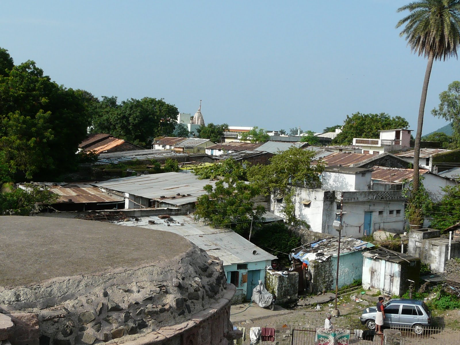
View across Mandu plateau from Lal Bangla (or Lal Bungalow). Note the agricultural land (which belongs to villagers), the open scrub land (which either belongs to the government or the “maharaja” of this area), and the fenced-in land around the monument. Cultivated fields, small hamlets and monuments are interestingly juxtaposed throughout Mandu
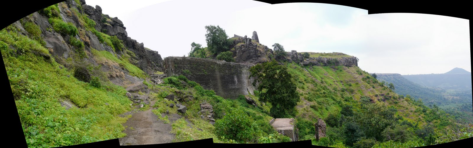
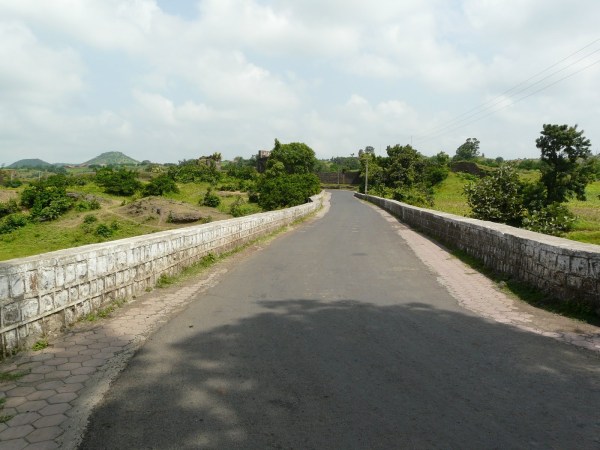
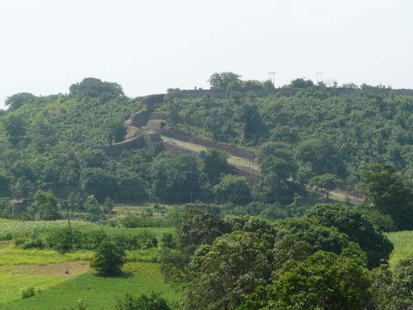
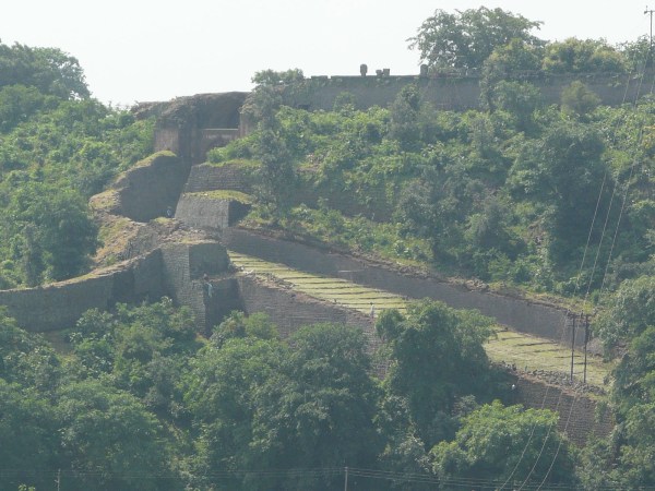
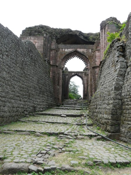
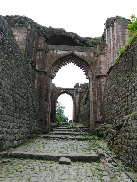
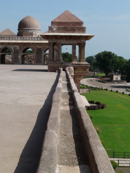
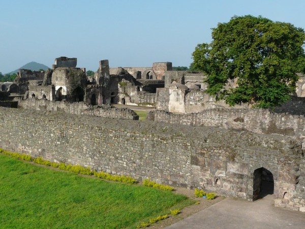
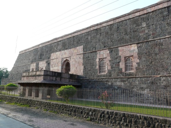
Mandu’s northern gates, fortifications and approach
The narrow “neck” joining Mandu plateau with the Malwa plateau to its north is also the main approach to Mandu, and is one the most heavily fortified areas of the fort.
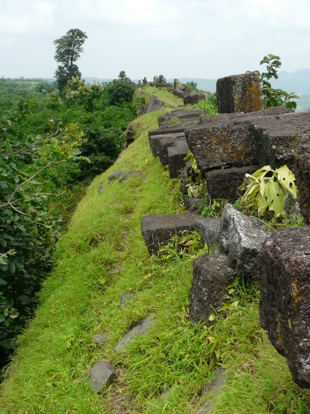
Mandu’s northern ramparts

Tombs on the approach to Mandu. These tombs are on the edge of the Malwa plateau

Looking at Malwa plateau from the Mandu ramparts
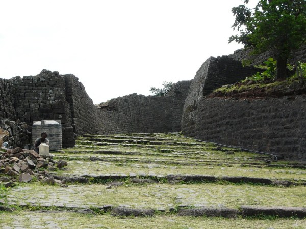
The various gates on the neck connecting the two plateaus
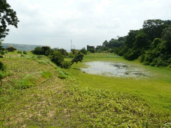
Causeway over the “moat”
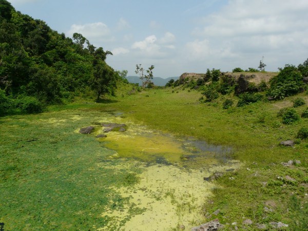
(What I’m calling) The moat of Mandu, now an irrigated strip since (I’m assuming) it is completely silted up
Alamgir Gate – the first gate on the approach to Mandu

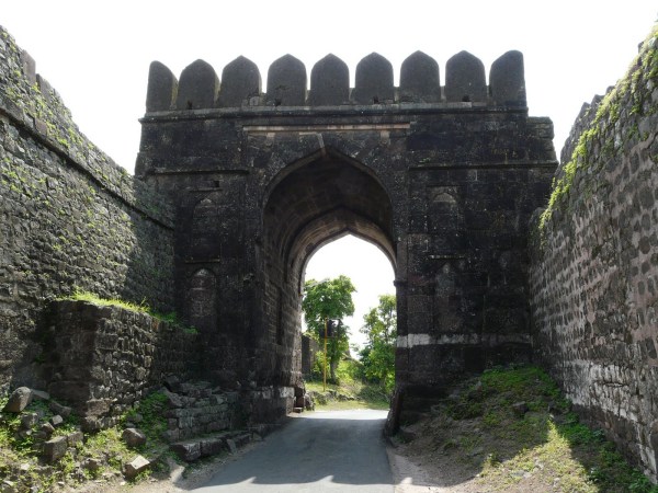
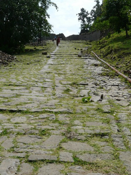
A far view of the old approach to Mandu – a steep incline up to Dilli Gate
The old approach leading up to Dilli Gate on the right, and the new road to the left

On the way up to Dilli Gate
Looking from Dilli Gate across the Malwa plateau and hills of the Vindhya range

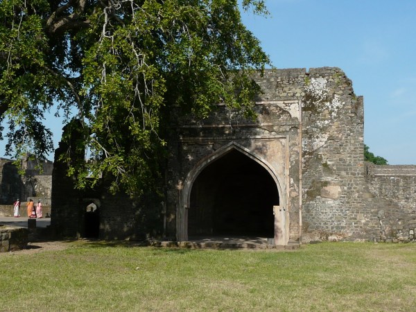
Dilli Gate
A small mosque adjacent to Dilli Gate (inside the fort)

Like my two favorite structures in Mandu, both of which happen to be mosques (and which I talk about later in this post), this one also reuses pillars from Hindu temples
Looking along the northern ramparts
Jali Mahal – a tomb that lies on the northern approach to Mandu, on the Malwa plateau side


Mandu’s architecture
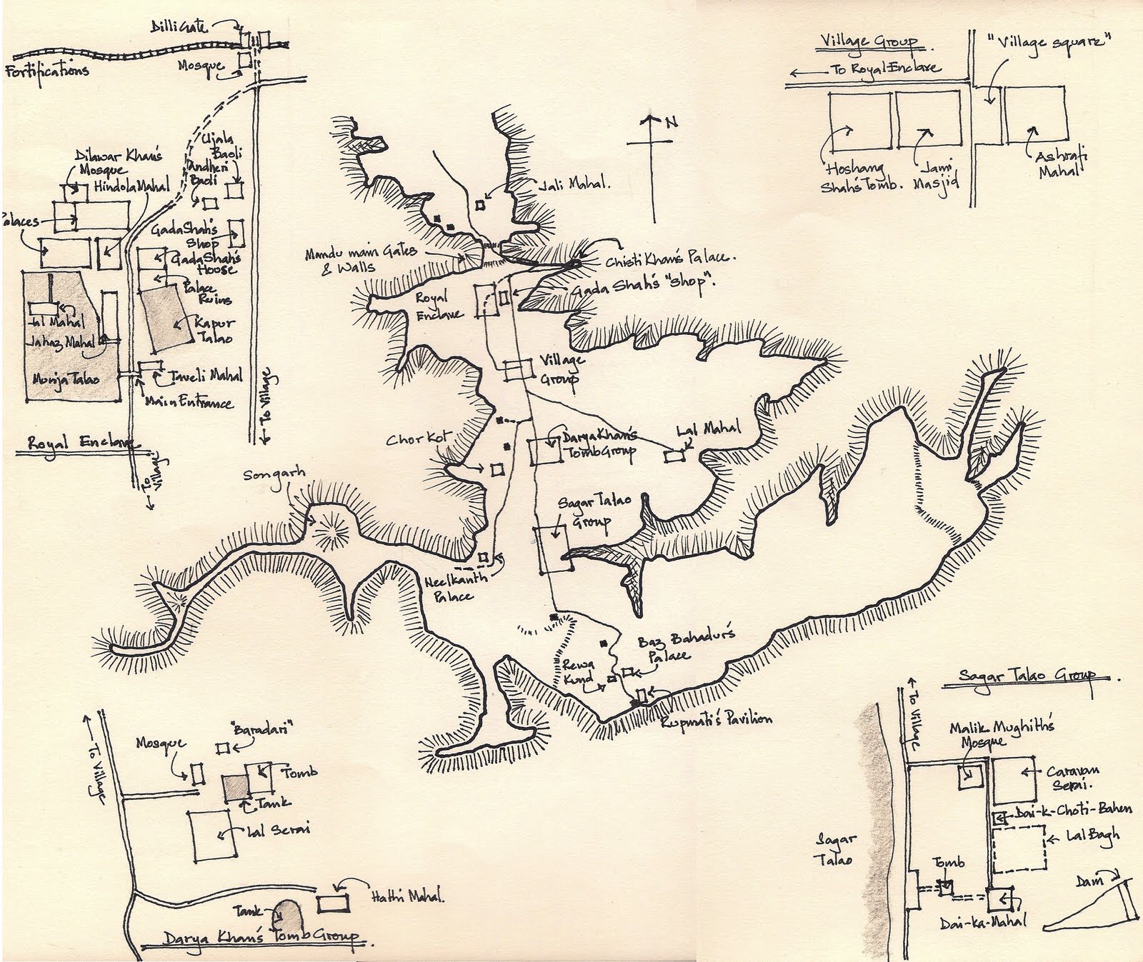
Before I get to the monuments themselves, here is a schematic map I drew of the location of Mandu’s historic structures. I haven’t come across an adequately accurate map of Mandu that locates its main architectural sites (I always hesitate to use the word archaeological for such structures/sites) in some detail, so I took a (schematic) stab at it. My map is based on the one inside ASI’s Mandu booklet, which is good, but has some errors.
This map probably won’t be any good just on its own, but rather is an additional site locator to go along with a more geographically accurate map of Mandu. Also, I’ve left out some of the more remote roads and monuments that I did not visit.
Map of Mandu’s architectural sites. Click on the map to enlarge, and feel free to print and use! The map is also on my flickr page
The existing structures around Mandu were mainly built from the early 15th c. to mid 16th c., when Mandu was the capital of the Malwa sultans. Evidence of Hindu structures existing before this time exists in the form of temple pillars used in early mosques, as well as the Lohani caves, and the fort was in the hands of Hindu rulers before the 14th c.
My two favorite structures in Mandu are two of the smaller (compared to the Jami Masjid) and earlier mosques from this period. Both seem to have been built from the remains of Hindu temples, and I don’t prefer them because of any syncretic affection, but rather because I think these are the two most “atmospheric” structures in Mandu. Many of the other buildings were too large and too plain to keep my interest.
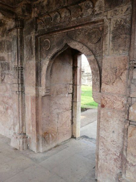
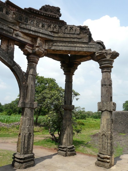
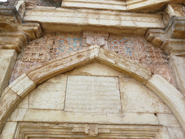
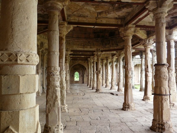
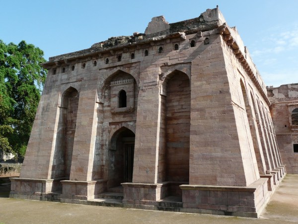
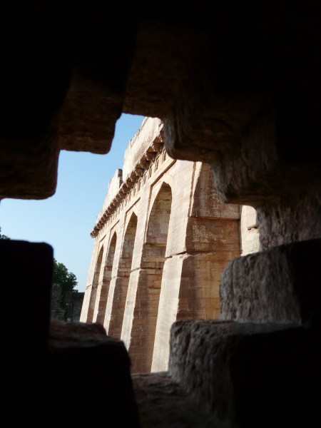
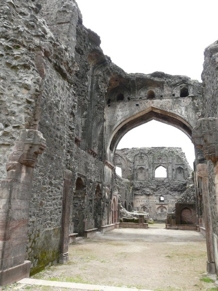
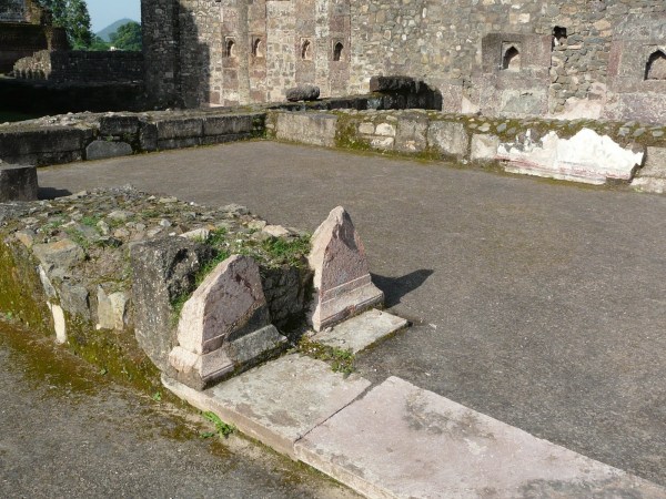
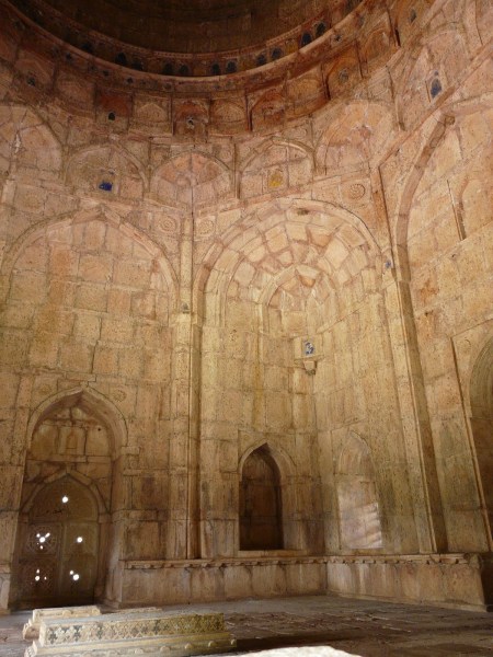
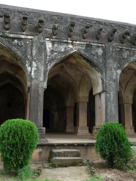
Dilawar Khan’s mosque, built in the early 15th c. and located among the “Royal Enclave” group of monuments, is tucked away and almost hidden at the northern edge of the group. It is accessed by a small opening in a plain high wall, and the open expanse of the mosque’s courtyard, flanked all around by sculpted stone columns, makes a pleasing contrast to the cave-like entrance. The array of columns in the main hall in front of the qibla wall is almost forest-like.
The small entrance to Dilawar Khan’s mosque

The mosque courtyard with plateaus and hills in the background
Entrance doorway and side arcade
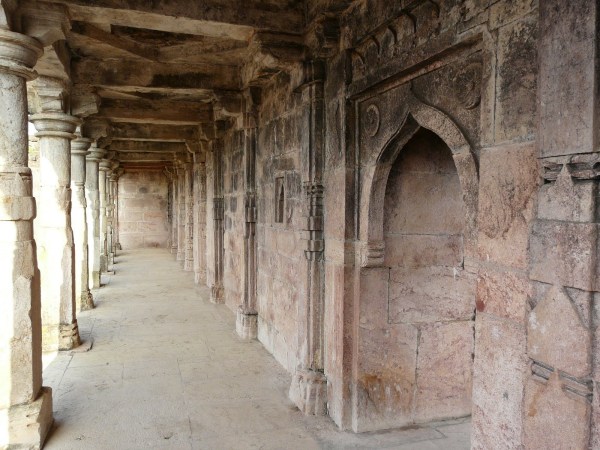
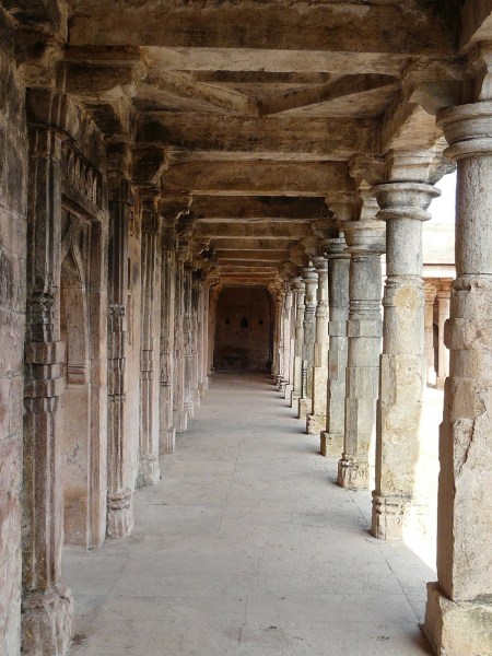
The main hall of the mosque
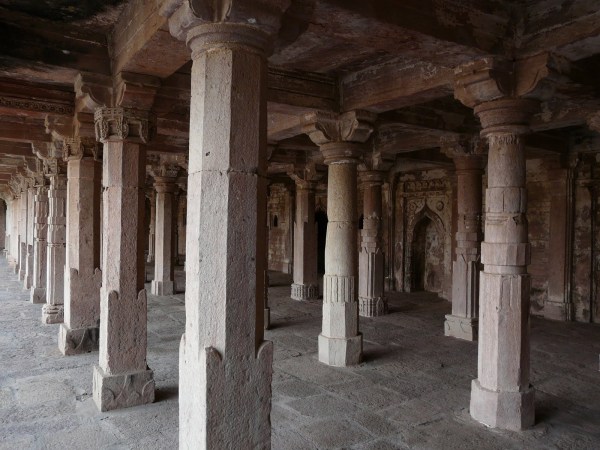


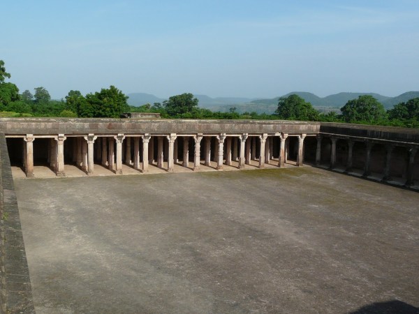
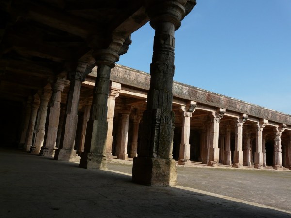
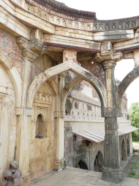
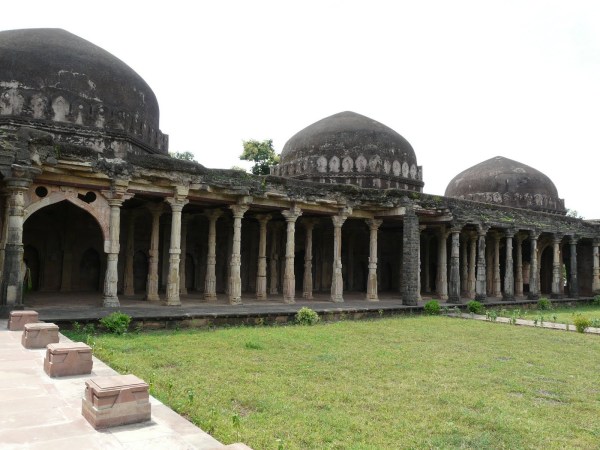
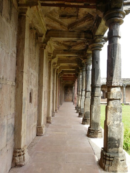
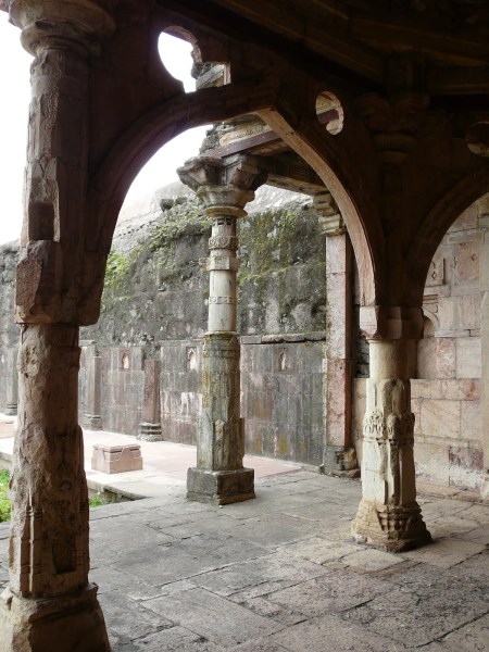
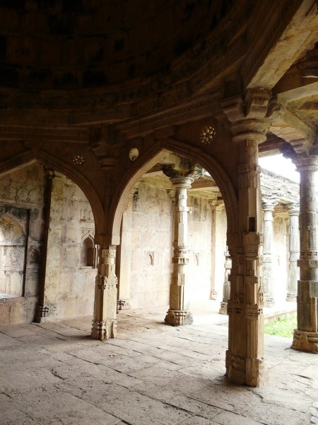
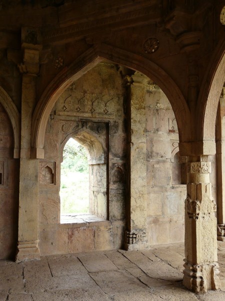
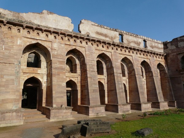
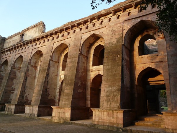
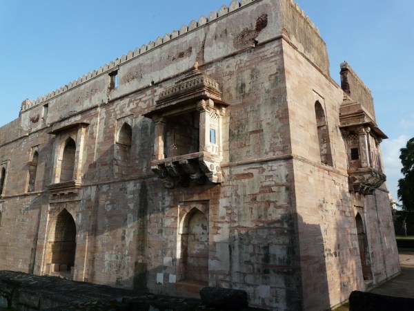
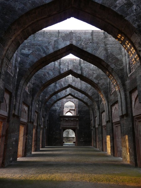
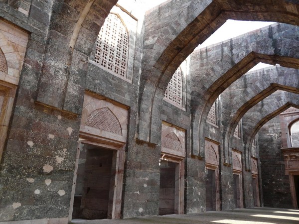
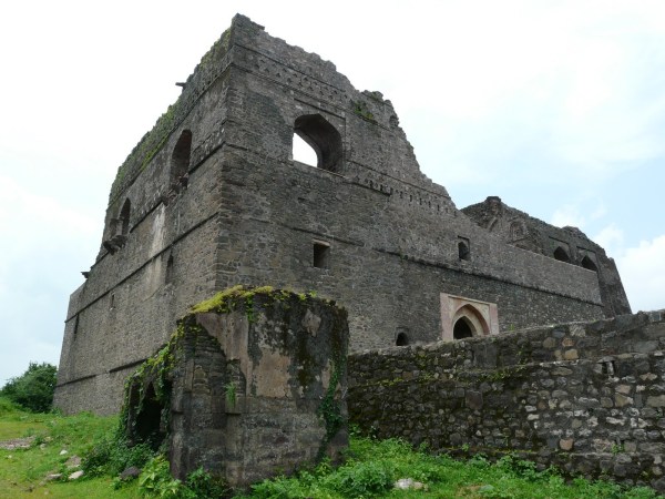
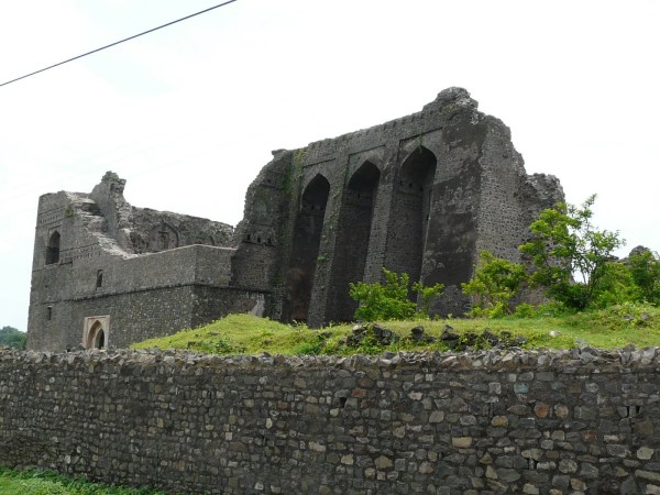
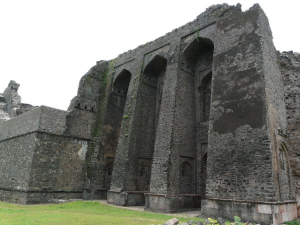
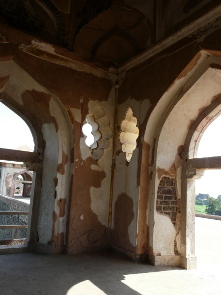
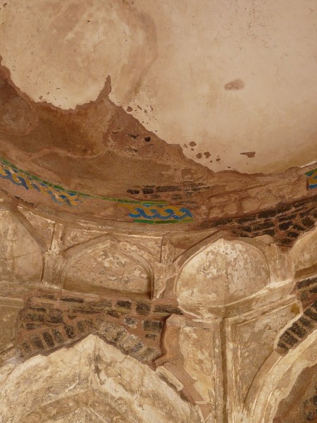
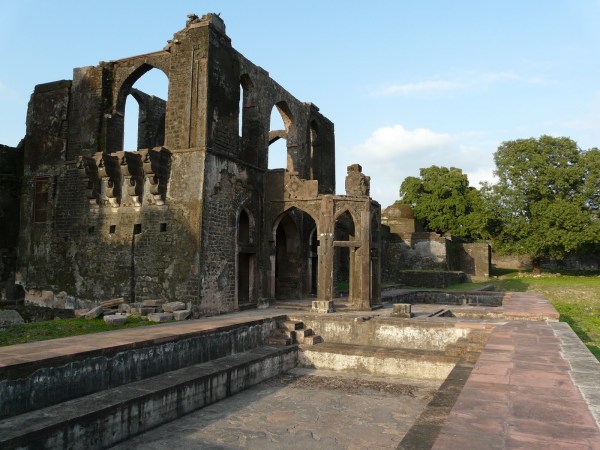
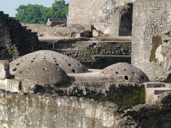
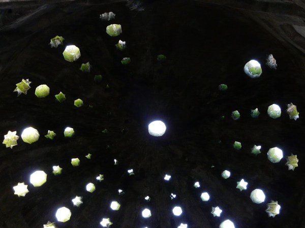
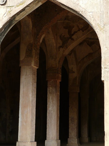
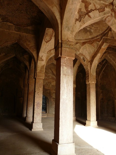
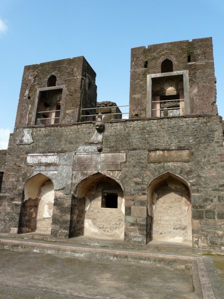
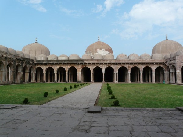
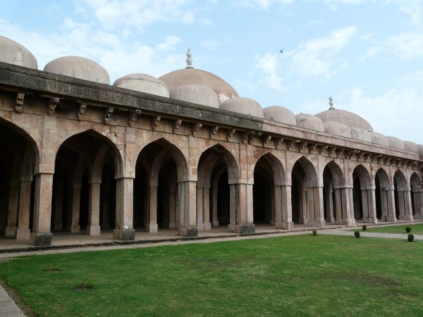
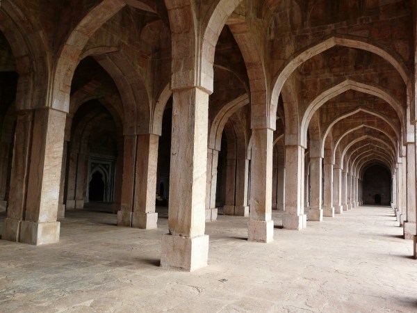
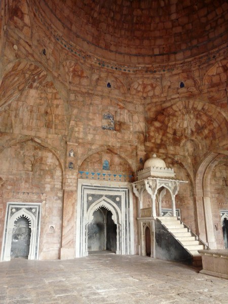
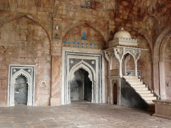
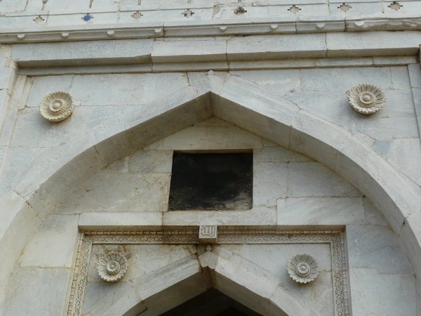
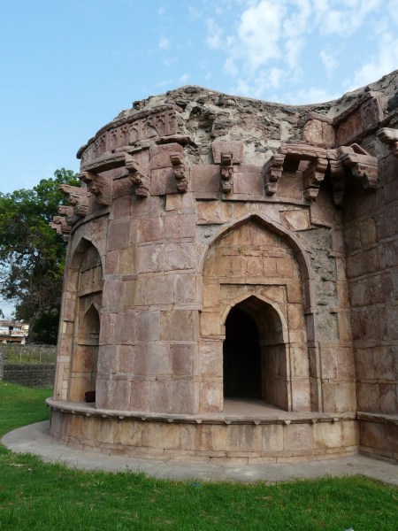
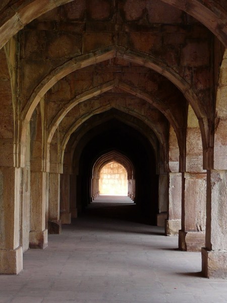
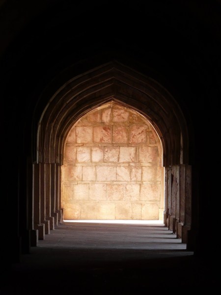
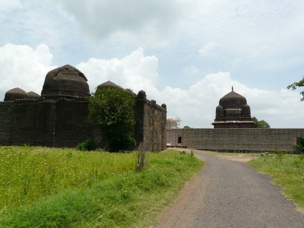
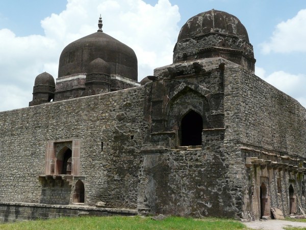
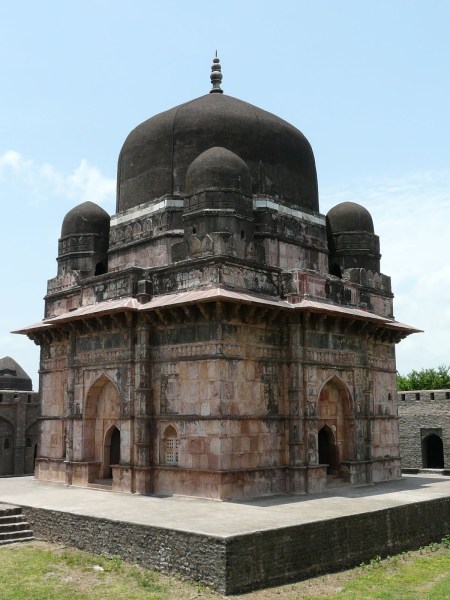
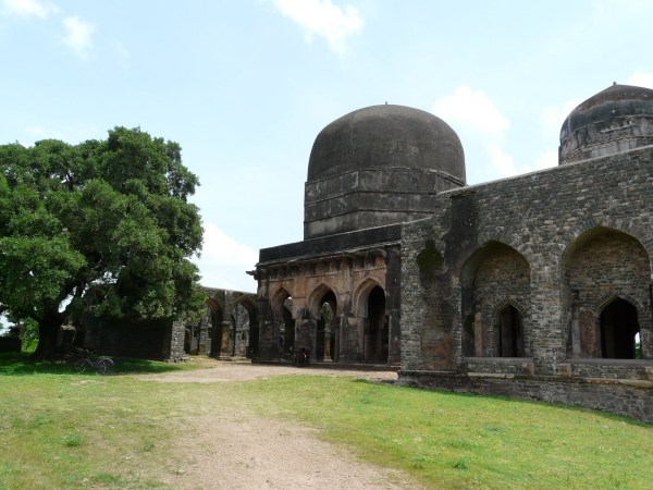
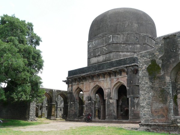
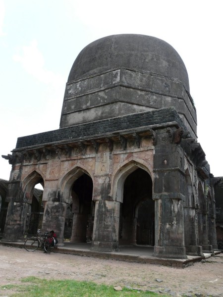
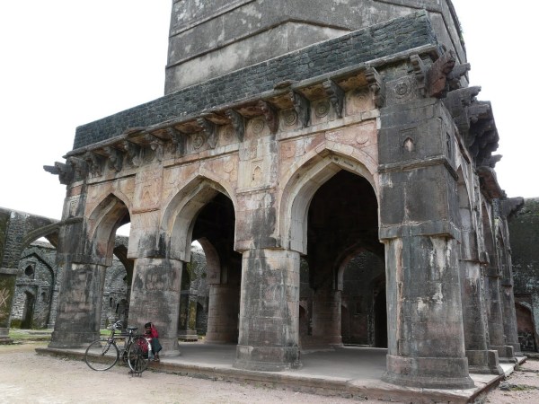
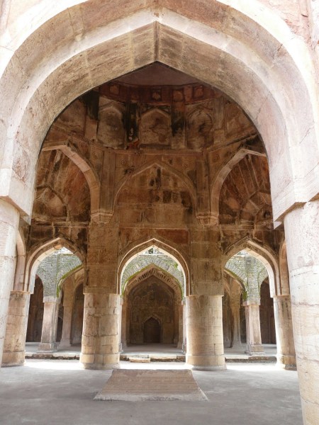
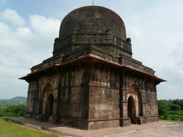
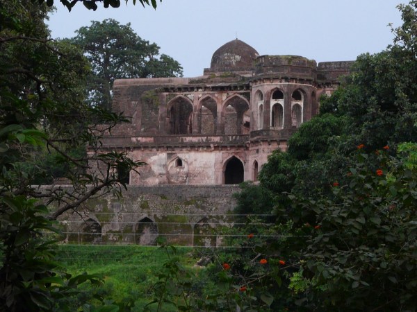
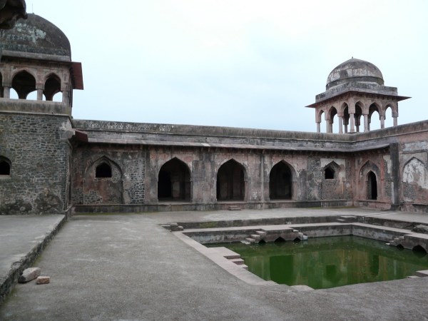
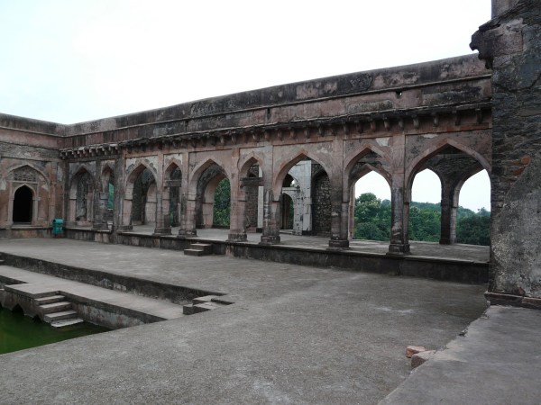
The other mosque is Malik Mughith’s mosque built in the mid 15th c., and has similar sculpted columns taken ostensibly from Hindu temples. It is bigger than Dilawar Khan’s mosque, and the main hall is topped by three well-proportioned and somewhat unusual domes, each being of equal size. Unlike Dilawar Khan’s mosque, this mosque had a grand entrance topped by a (now missing) dome. One intriguing feature of this mosque is the way it’s domes are supported – by an octagonal system of columns and arches, which it shares with many Hindu and Jain temples in central India. The hypostyle hall of this mosque is even more beautiful and forest-like than Dilawar Khan’s, and the columns of this mosque are more delicate and intricately carved.
Malik Mughith’s mosque exterior
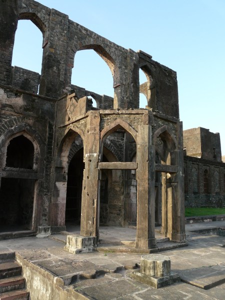
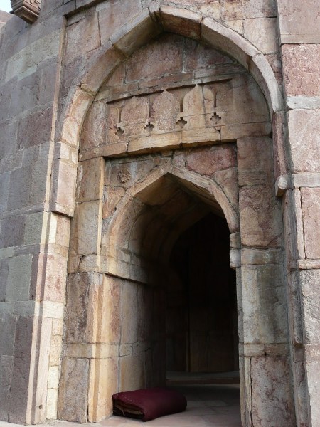
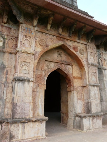
Mosque entrance gateway. You can see the octagonal arrangement of supporting columns and arches here, and part of the narrow drum that once lay at the base of the dome
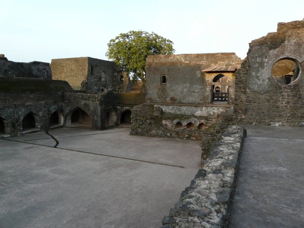
Mosque courtyard. The three equally sized domes are exquisitely proportioned and shaped!

Side arcade


One of the side domes of the main hall, with the same octagonal column support arrangement


The main hall

The central dome is visible in the middle-ground

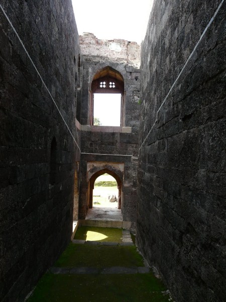
View towards the corner arrangement


The other corner
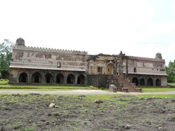
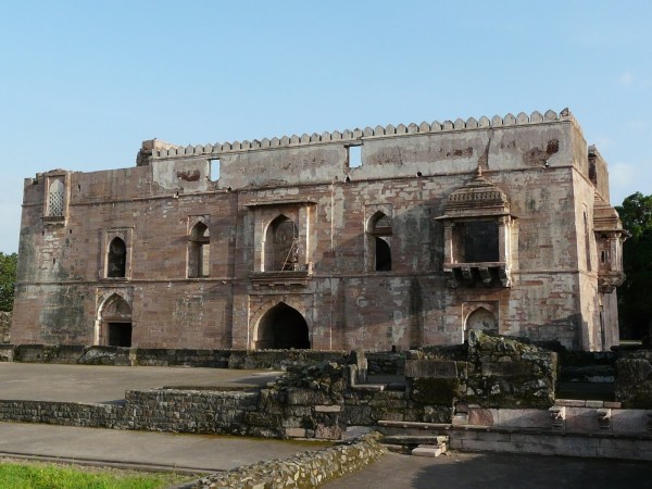
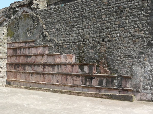
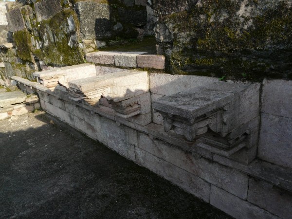
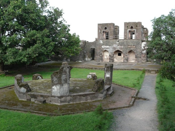
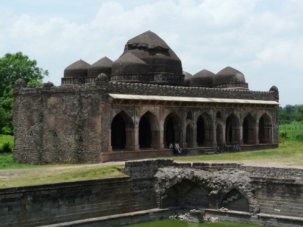
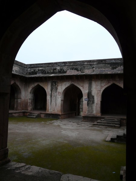
Another interesting duo of buildings are the two “audience halls” in Mandu – the Hindola Mahal and what is known as Gada Shah’s “Shop”. The “shop” is sometimes referred to as a granary or warehose, but I don’t see how this is possible because it is so close in design to the Hindola Mahal as to be obviously another audience hall.
The interior of both structures are reminiscent of the naves of Romanesque cathedrals, with high arched ceilings that are supported by enormously buttressed walls. The roof and many arches of Gada Shah’s Shop are now collapsed despite it’s thick walls and buttresses, though Hindola Mahal is still standing (or was extensively repaired at some point of time).
Both these buildings remind me of a similar structure in Bidar Fort in Karnataka, which had a similar arrangement. Bidar remains my favorite Deccan fort visit.
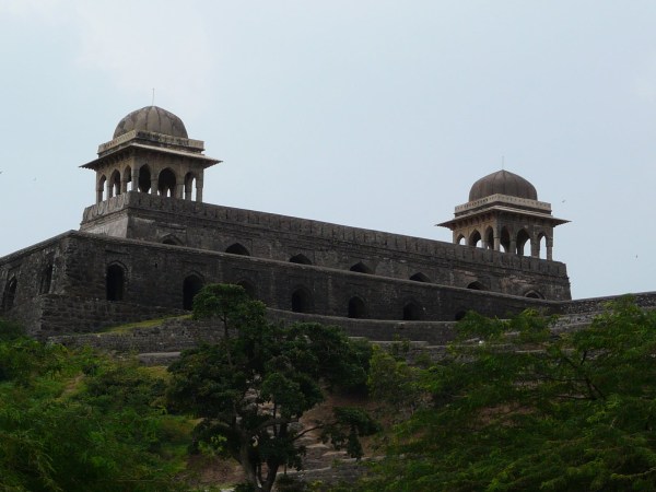
Hindola Mahal, from the late 15th c.
The later northern extension to Hindola Mahal
Hindola Mahal interiors
Ramp leading up to northern extension’s upper floor
Gada Shah’s Shop, from the early 16th c.

One of the “double” arches is still standing
Some facade detailing seems to still be in place
Now for some of Mandu’s other buildings, according to their groupings:
Royal Enclave
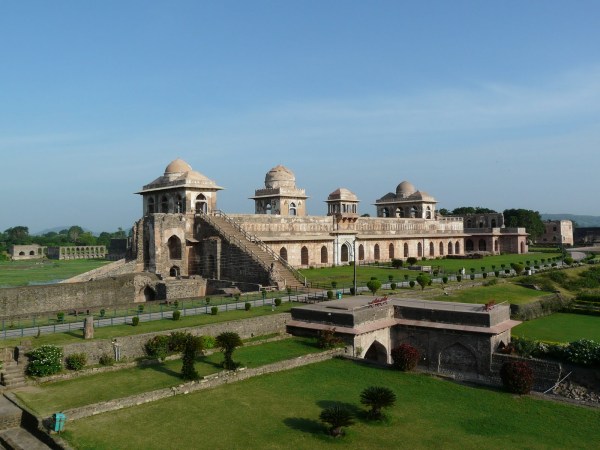
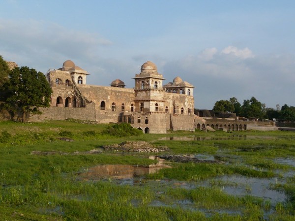
Apart from Dilawar Khan’s mosque and Hindola Mahal, this group, which is where the main palaces were located, also includes Mandu’s most famous and iconic structure – the Jahaz Mahal, or “ship palace”.
Jahaz Mahal, flanked on both sides by water bodies – the Kapur Talao and Munja Talao
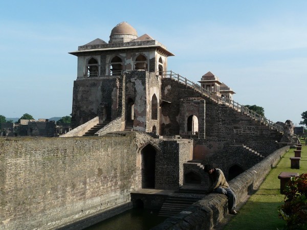

Pavilions on the upper floor


Water channel

View of the Munja Talao from a lower floor window
The pool in Jahaz Mahal, now filled with dirty water and an eyesore of a fountain at its center
Jahaz Mahal from Munja Talao
Jahaz Mahal from Jal Mahal

View of Munja Talao, with Jal Mahal within the lake, and main palace buildings on the banks

Jal Mahal
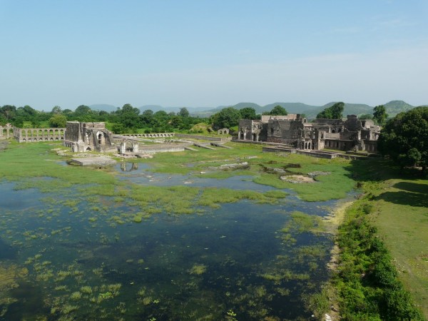
View across the Royal Enclave and Kapur Talao
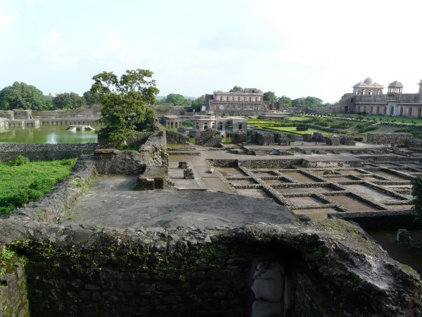
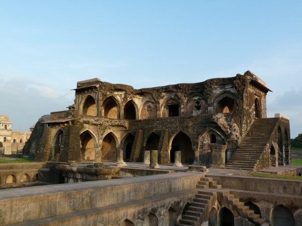
Main palace buildings


Hammam (baths) domes
Hammam dome from inside
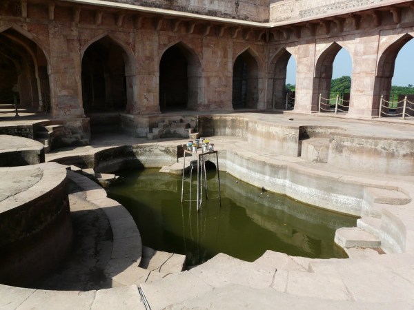
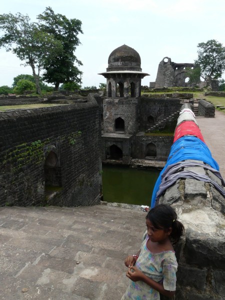
Champa baoli – a well within the main palace, which also helped cool a basement layer of the palace

Part of the facing material of the palace still intact/restored
Hypostyle hall in a side palace
Marble brackets
Probably an ablution pool?

Base of a marble faced column still intact
Painted plaster still intact

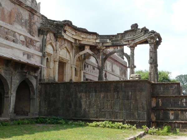
Gada Shah’s House, with the remains of an octagonal pavilion in the garden
The house resembles the entrance facade of a Romanesque church!
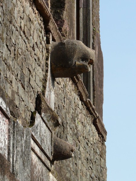
Water spouts
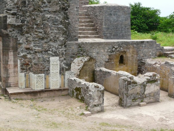
Village Group
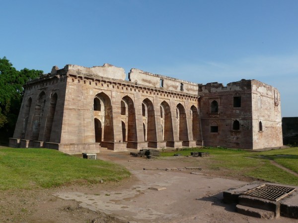
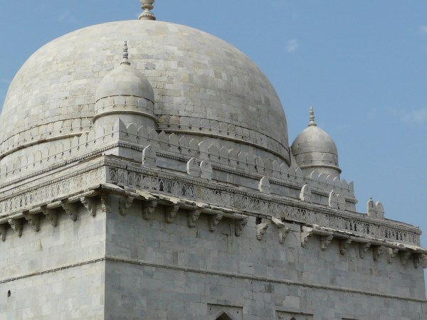
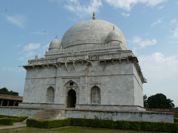
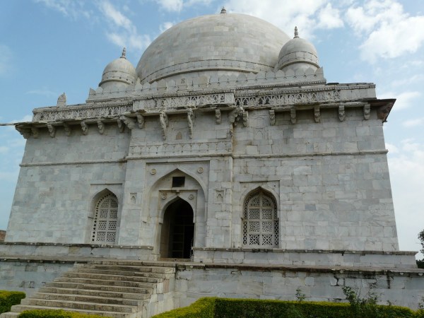
This group consists of the main Jami Masjid, Hoshang Shah’s tomb and the combined Ashrafi Mahal madrasa/Mahmud Jhalji’s tomb. These structures are located within the main village of Mandu, hence the group’s name. Hoshang Shah’s tomb was a bonus for me on this trip – for the past few years I had wrongly assumed that this tomb was in Hoshangabad, which is near Bhopal, so was pleasantly surprised when I realized that it was here in Mandu. Hoshang Shah’s tomb is important in South Asia’s architectural history as it was one of the prototypes for the Taj Mahal.
View across Mandu village. I should have taken a few more photographs of the village and present-day Mandu!
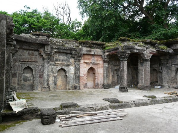
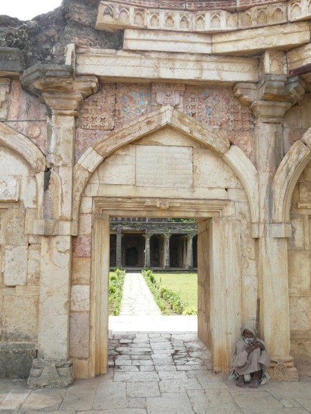
Jami Masjid from Ashrafi Mahal
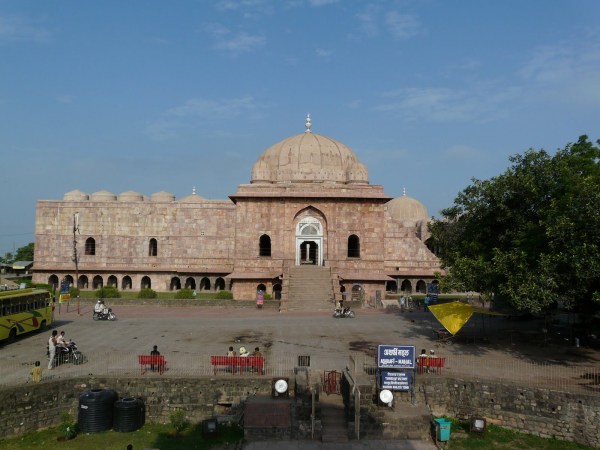
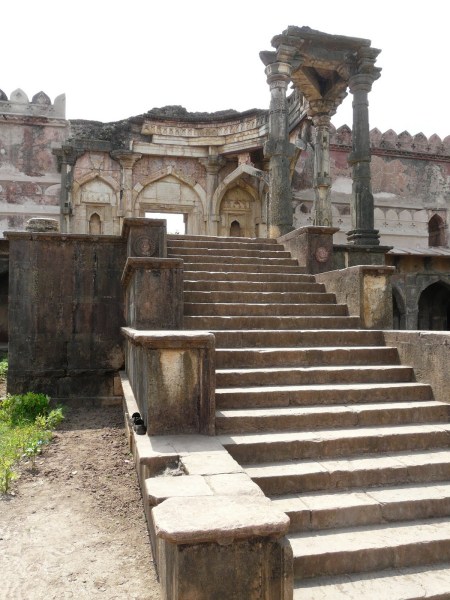
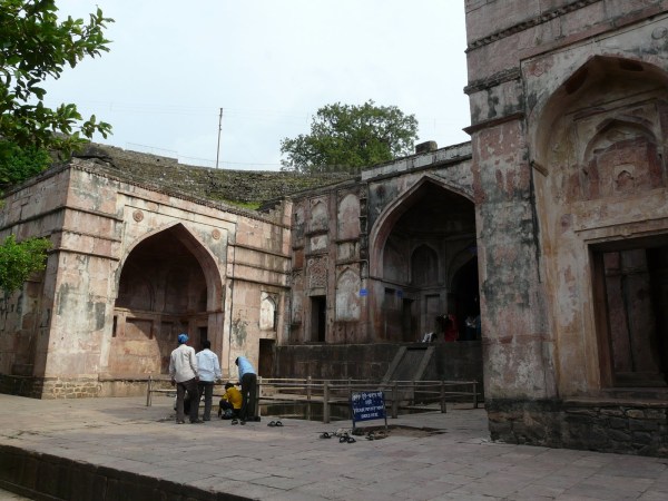
Jami Masjid
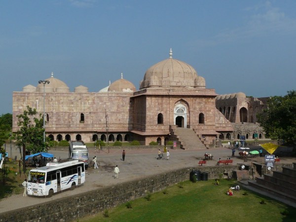
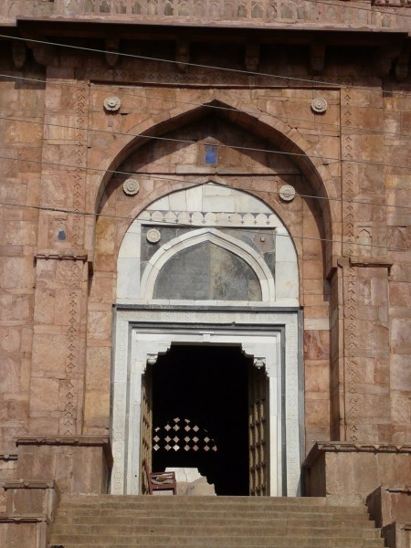
Jami Masjid entrance
Courtyard
Main hall facade
Main hall
Central dome
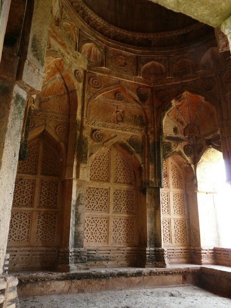
Mihrab and minbar
Mosque external wall
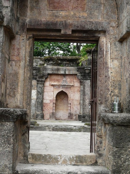
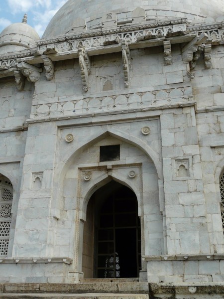
Side entrance gateway to the mosque. This entrance leads to the entrance of Hoshang Shah’s tomb

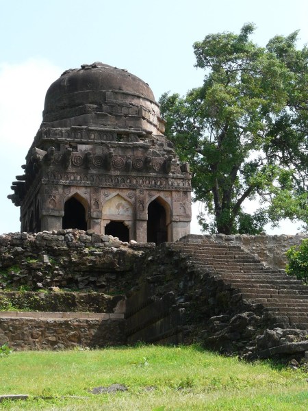
Entrance to Hoshang Shah’s tomb
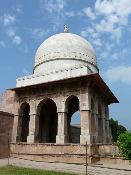
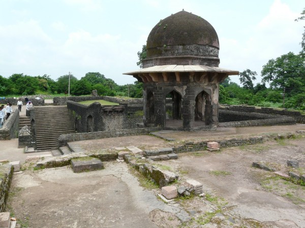
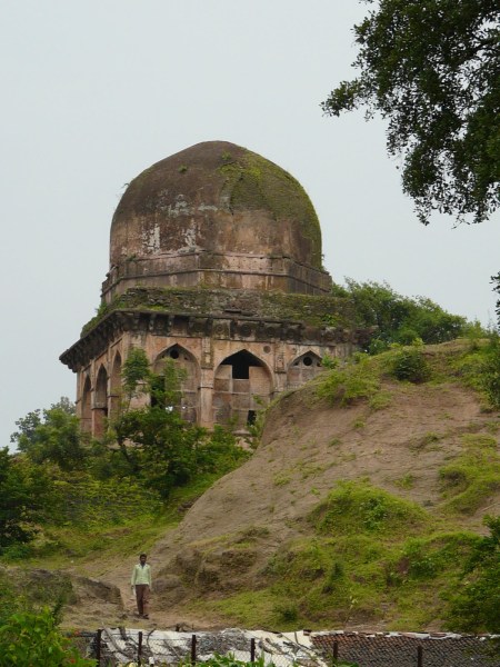
Hoshang Shah’s tomb


Entrance gateway to Mahmud Khalji’s tomb
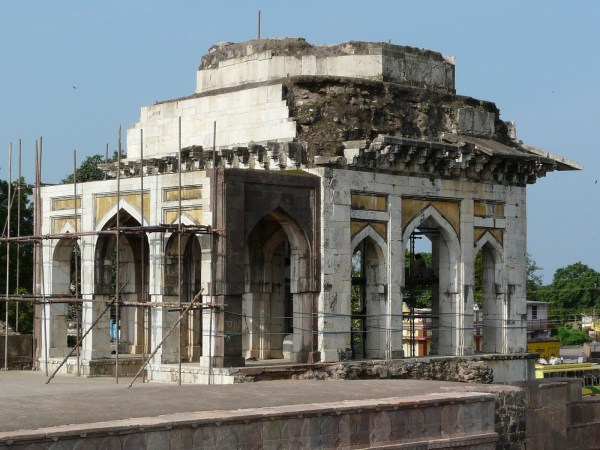
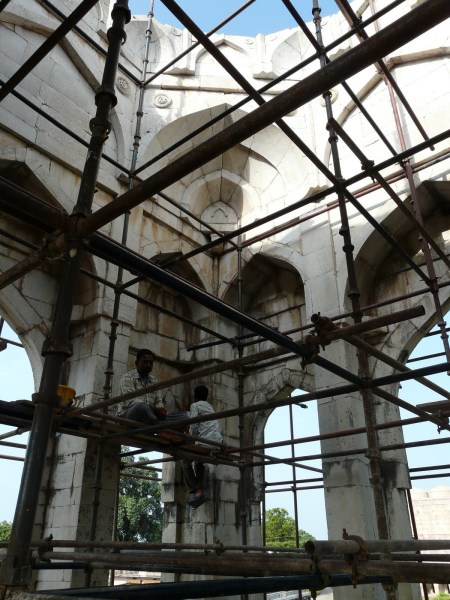
Repair work inside the gateway
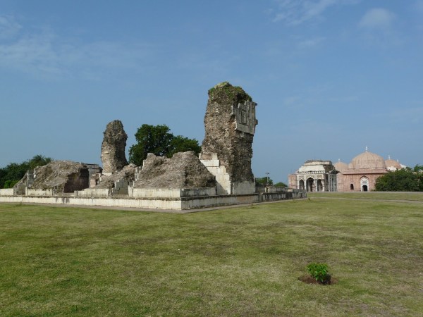
Remains of Mahmud Khalji’s tomb, with the gaeway and Jami Masjid in background


A side turret of Ashrafi Mahal madrasa, which now forms the base of Mahmud Khalji’s tomb
Ashrafi Mahal
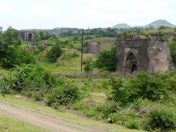
Darya Khan’s Tomb Group
A small cluster of buildings comprising of a tomb, a mosque, a palace and a “baradari”. The nearby Hathi Mahal (so called because of it’s large elephant leg-like columns), a tomb subsequently surrounded very closely and injudiciously by a set of rooms, is also included in this group.
Approach to Darya Khan’s tomb group, with the tomb in the background and mosque to the left
Tomb and enclosing walls

Darya Khan’s tomb

Tomb details

Tomb interior
Looking out from the tomb enclosure to a nearby palace structure

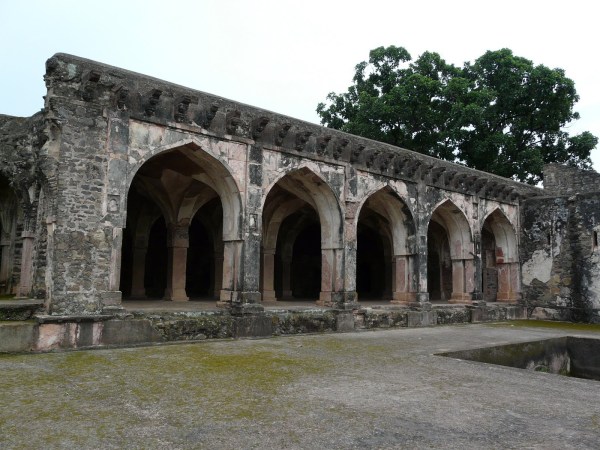
Mosque
Hathi Mahal
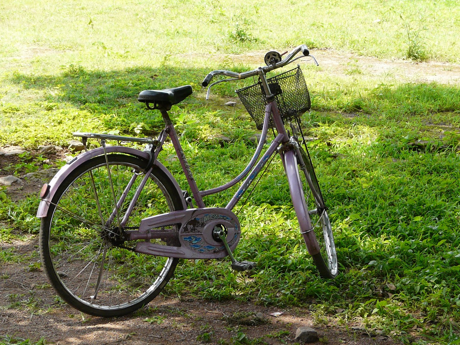
My trusted rental bike “dhanno”, that I used to get around Mandu
Sagar Talao Group
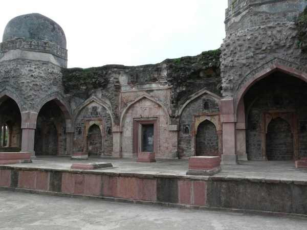
This group includes Malik Mughith’s mosque, as well as a large though plain serai, and a set of tombs.
Dai ka Mahal is a tomb with an attached mosque and rooms

Dai ka Mahal
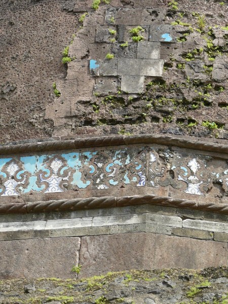
The stone used for many of Mandu’s monuments has this particular color and flaky weathering pattern, which makes for an interesting texture close up. Where the stone is darkened is due to rain
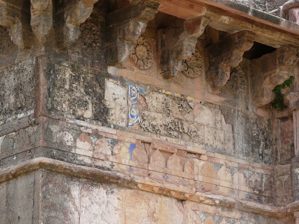
Tilework detail on tomb
Mosque
Looking out into the nearby ravine from Dai ka Mahal

A dam at the top of the ravine near Dai ka Mahal

Dai ki Choti Behen ka Mahal! Near it’s bigger sister, possibly had a mosque attached to it as well – the arrangement looks pretty similar


Tilework detail on dome
Rewa Kund Group
This group, at the southern edge of the Mandu plateau, contains the other well known and iconic building of Mandu – Roopmati’s Pavilion, as well as the Rewa Kund tank and Baz Bahadur’s palace. I visited these structures late in the evening of my last day in Mandu.
Rewa Kund

Baz Bahadur’s palace from it’s approach road
Baz Bhadur’s palace courtyard and rooftop pavilions

Pavilion in Baz Bahadur’s palace
View from pavilion
Baz Bahadur’s palace
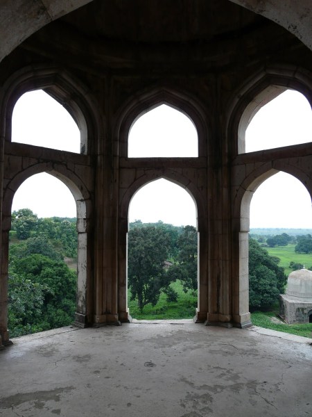
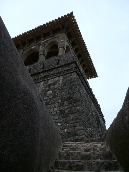
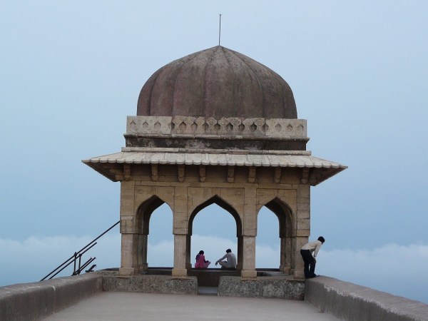
Roopmati’s pavilion
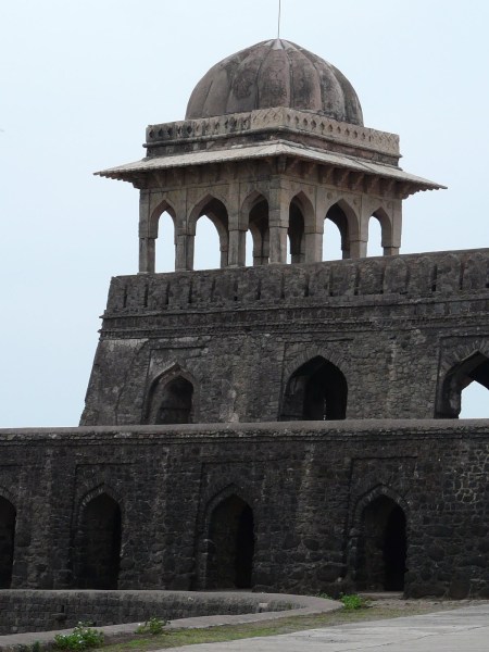

Looking like a Ladhaki/Tibetan monastery
Looking out onto the Mandu plateau
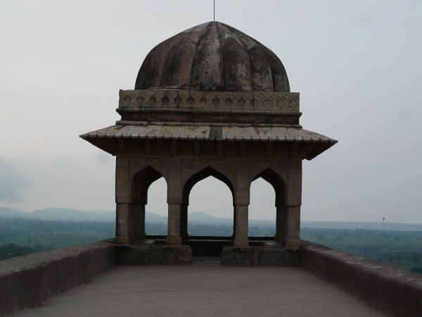
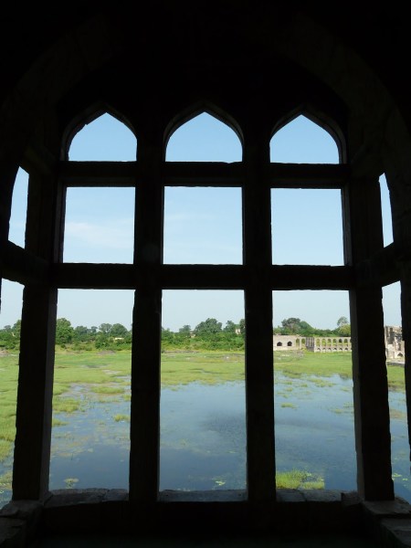
Looking out onto the Narmada plains. According to legend, on clear days Roopmati would look out onto the shimmering sliver of water that was the far-off Narmada. Obviously not on days like the one I visited on!
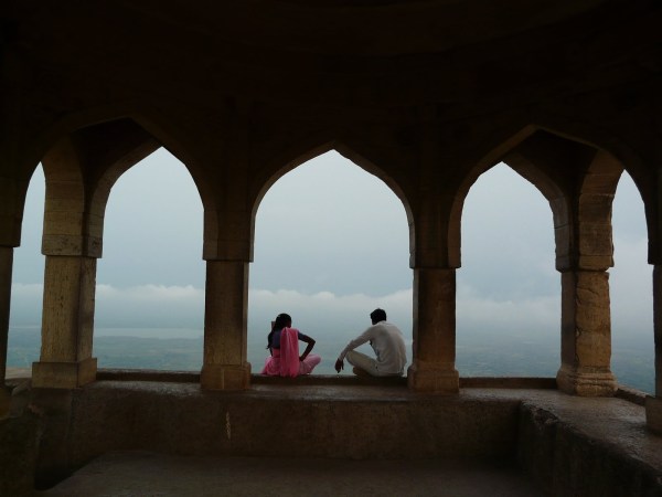
The plains visible below the clouds

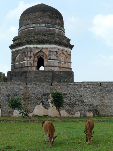
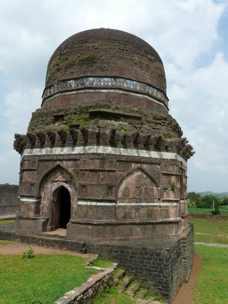
Other Structures around Mandu
Assorted structures from all around the Mandu plateau:
Ujala baoli, with Gada Shah’s Shop in the background
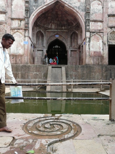
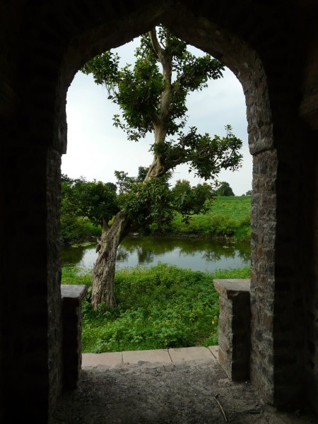
Neelkanth palace
Lohani caves
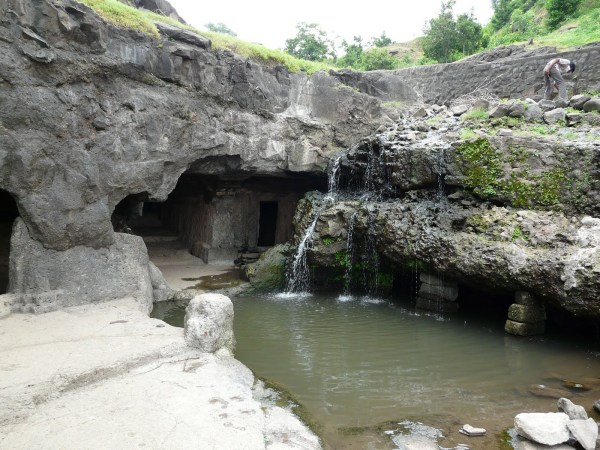
Dam near Lohani caves

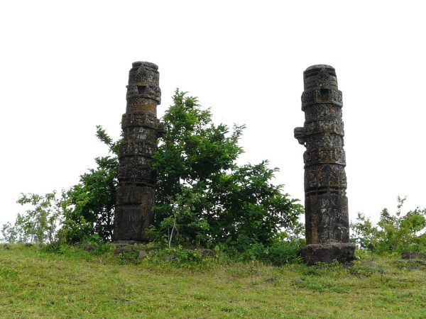
Pillars from Hindu temples erected near Lohani caves
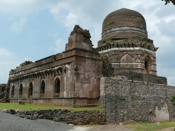
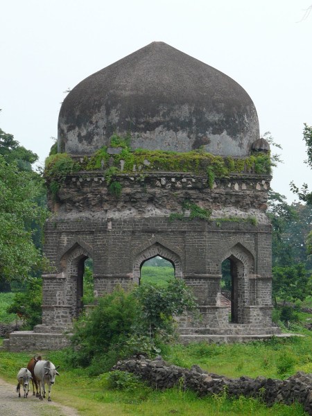
Octagonal tomb on the way to Lal Bangla/Bungalow

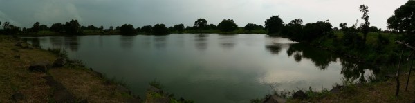
Lake in front of Lal Bangla
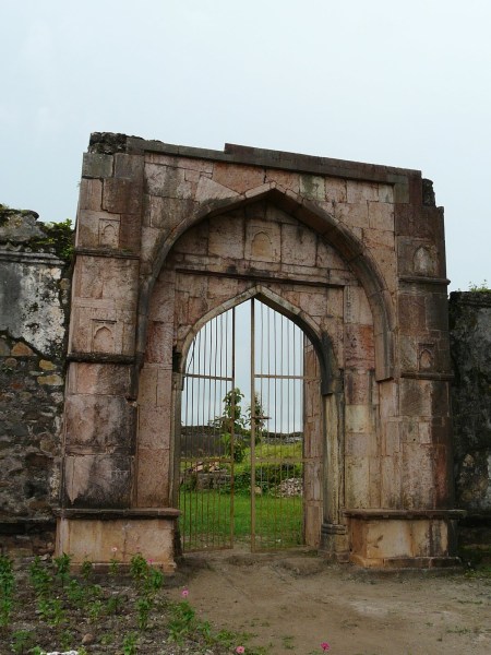
Lal Bangla entrance
Lal Bangla
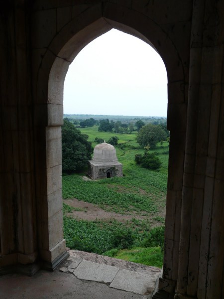
Tomb on the way to Rewa Kund group
Tomb among cultivated fields on the way to Rewa Kund group

loved this one!anubha
LikeLike
wonderful job & fantastic photography
LikeLike
wonderful!breathtaking! Love the pics of the pavilion overlooking the sweep of the horizon.-Tarun,New Delhi
LikeLike
I can only say that it is a photographic journey of Mandu. Well done.
LikeLike
Nice documentation …. thanks …..Prabir Biswas, KOlkata
…
LikeLike
very nicely put… especially the sketched map.
LikeLike
good photographical representation…… i could literally remember my journey through mandu’s beautiful historical past and glorifying architecture
LikeLike