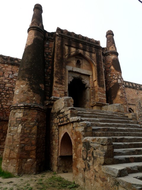
Qila Rai Pithora Walls (And A Little Bit Of Jahanpanah)

Many Dilliwalas are familiar with the portion of the fortifications of Qila Rai Pithora (which date back to the 12th c. AD) that are visible along Press Enclave Road along the Qutb Golf Course boundary. There was also a portion of the wall that stuck out onto Aurobindo Marg just north of Lado Sarai that was under litigation for many years and which was finally (sometime in the 1990s I think) torn down to widen Aurobindo Marg. And then there are the Lal Kot fortification ruins north of Mahrauli in the Sanjay Van area that I had covered in my Mehrauli post. Continue reading

Chirag Dilli – aerial photo

Chirag Dilli is the next site on my list to visit. I might not get there till late-Dec/Jan since I have other things to do as well (like my actual research!), but get there I will (hopefully!) :)

The settlement of Chirag Dilli grew around the abode and then tomb of a 14th c. Sufi saint by the same name, and later a square protective wall was built around the settlement. The wall is mostly gone now, but the present village of Chirag Dilli still conforms to the square shape. Spiro Kostof was right!!! :P

Chirag Dilli.

Khirki Masjid – aerial photo

An interesting aerial shot of one of the sites I was talking about before – Khirki Masjid. This is a 14th c. mosque that is unusual because much of it is covered, as opposed to having a large central open courtyard. Instead, this has 4 small courtyards with wide “passages” between them. From the sky the shape is pretty interesting, you can see it as the checkered square in the lower left quarter of the photo. Continue reading

Satpula!

Couldn’t resist mentioning one more building from my Jahanpanah excursion (that’s the wider site where the two mosques from the previous blog entry are located as well). This might look like a boring old building, but I’m really fascinated with historical buildings that involve water-works, so had to highlight it! Click on the image to go to the set.

Satpula.